150 Years of the Tricolor in the Antipodes
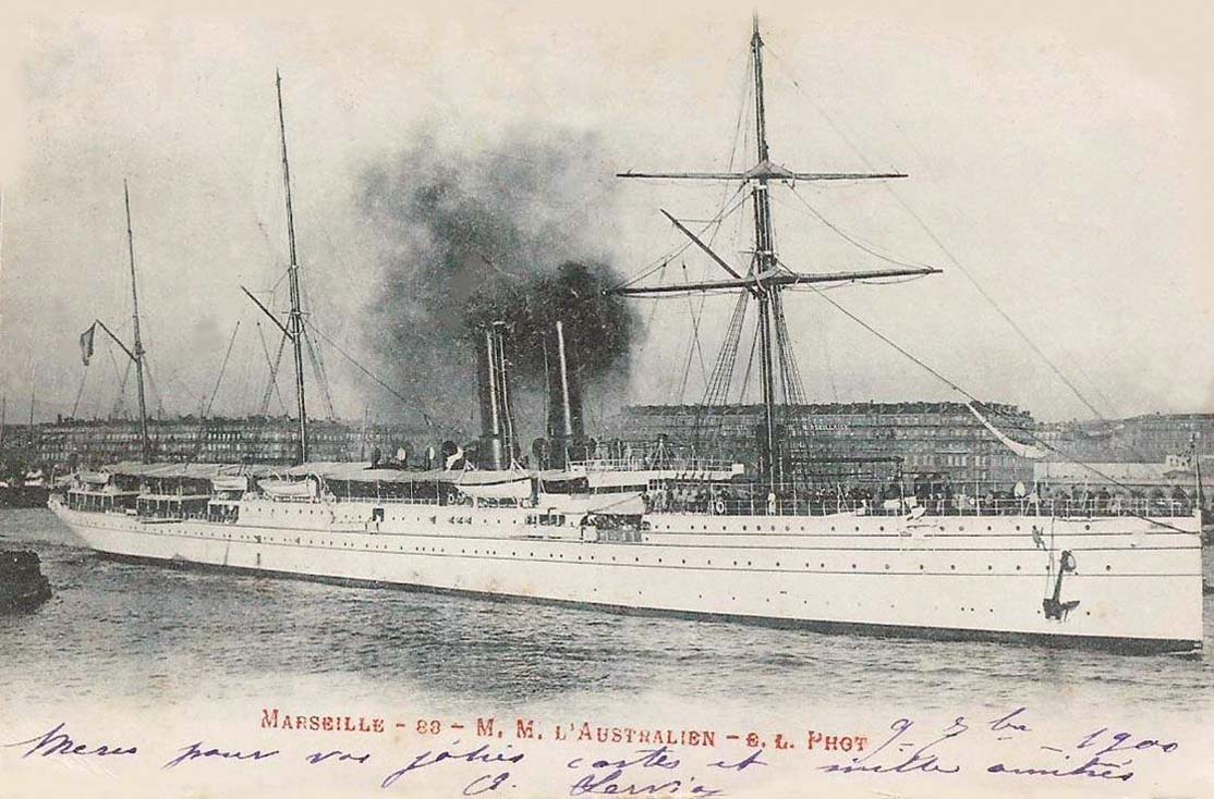
The opening of the Suez Canal on 18th November 1869, designed by the French engineer Vicomte Ferdinand de Lesseps, cut over two thousand miles off a voyage by French vessels owned by Messageries Maritimes, established in 1851, on their voyages to the French colonies in the Far East and the South Pacific. The opening ceremony convoy through the Suez Canal was headed by the French Royal yacht Aigle, with the Messageries Maritimes mail steamer Peluse as second in the line with the company steamers Thabor and Godavery also in the same convoy. A regular service to the colonies demanded organisation and communication, with French submarine telegraph cables laid across the Mediterranean in 1864 connecting within a few years with the 1873 cables of the Eastern Extension, Australasian and China Telegraph Company, and the 1876 cable connecting Australia with New Zealand. Nine new passenger and cargo steamers for the Far Eastern service, and eight new passenger and cargo steamers for the Noumea service via Australian ports, were then completed for Messageries Maritimes between 1869 and 1884.
French Influence In The South Pacific
French influence in the South Pacific is still very strong over 250 years after Capitaine Louis-Antoine Bougainville (1729-1811), a French admiral and explorer, made several important discoveries in the Pacific. He was a contemporary of Capt. James Cook and also circumnavigated the globe just before that of Cook. He sailed from Nantes with two ships in November 1766 and set up a small settlement on the Falklands before moving into the Pacific. He made several island discoveries in the Tuamotu Group before arriving in Tahiti, narrowly missing becoming their discoverer, as the British Capt. Wallis had arrived only a few months previously. By June 1767, he had discovered Samoa, the New Hebrides, Espiritu Santo, the Solomon Islands, naming Bougainville Island after himself. Bougainville Strait separates this island from Choiseul in the Solomons, and the name is also applied to the strait between Mallicollo and Espiritu Santo islands of the New Hebrides. He sailed past the many outer islands of present day Papua New Guinea, and arrived back via the Cape of Good Hope at St. Malo on 16th March 1769, losing only seven men from the 330 crew of two ships.

This enlightening voyage of exploration is the reason behind the strong French present day influence in French Polynesia and the South West Pacific. Capitaine Dumont d’Urville in 1827 sailed the Pacific searching for his lost countryman, Comte de la Perouse, whose ship had sunk near the Solomons in 1788. The writings of d’Urville on this voyage and another ten years later established the concept of three great subdivisions of the Pacific into Melanesia, Micronesia and Polynesia.
French Polynesia comprises several scattered and widely spread out groups of islands lying two thirds of the way between Panama and New Zealand. The Windward Islands of Tahiti and Moorea, and the Leeward Islands (Iles Sous le Vent) lying 160 kilometres to NW of Tahiti, form the main Society Islands group, along with the Tuamotu Archipelago of eighty atolls, the Marquesas Archipelago lying 1,450 kilometres to north east of Tahiti, and the Gambier Islands lying 1,600 kilometres to south east of Tahiti. In total, there are 35 islands and 83 atolls in French Polynesia, of which 76 are inhabited. The total land area of French Polynesia is 1,500 square miles, not much compared to the 64 million square miles of the Pacific Ocean. The highest point on Tahiti is Mount Orahena, but most of the population of 78,000 live in Papeete. The native population when the French and British first arrived was actually higher at 100,000, but disease carried by the white man soon decimated this figure to only six thousand.
The main port of Port Autonome de Papeete on Tahiti is where the CMA CGM and Marfret vessels call on their service to Noumea on New Caledonia and onward to Australian and New Zealand ports. The last Bank Line vessels called here in September 2009 and used the same berths as the chartered CMA CGM and Marfret vessels use today to load copra, sugar cane, mother of pearl, coffee and vanilla. The Passenger Terminal (Gare Maritime) is used by 1.6 million inter-island passengers from Moorea (25 kilometres across the Sea of the Moon), Bora Bora, Tahaa and Raiatea, and by fifteen inter-island ferries including a car ferry and a high speed catamaran of Aremiti Ferries. There are around ten thousand international cruise passengers annually. A total of 1.9 million tonnes of cargo and 70,000 TEU of containers are handled annually at the cargo port zone of Motu Uta. Papeete lies at the north west corner of Tahiti Nui, which has a narrow connection to the smaller island of Tahiti Iti. Tahiti has white beaches, turquoise lagoons and many vertical waterfalls and is a gorgeous cruise and holiday destination.
Subscribe today to read the full article!
Simply click below to subscribe and not only read the full article instantly, but gain unparalleled access to the specialist magazine for shipping enthusiasts.


Comments
Sorry, comments are closed for this item